Showing posts with label Lewis and Clark. Show all posts

Thursday, July 2, 2009

Warrenton, Oregon

Day 40, Our last stop for the Lewis and Clark tour. How sad we began to feel as our trip was near ending. We began the last leg of our trip with a chili dinner that we prepared for the guests. At our orientation meeting, one of our guests, who had been on many Adventure Caravan trips, mentioned that he had everything “AC” accept a pair of underwear. We also used this opportunity to present him with his own“Adventure Caravan Boxers.”


Day 41, We visited Fort Clatsop, where we saw a short film and toured a recreation of the original Fort. Actually, it’s the third fort. The first one was the original, the second one was a recreation, which burned down, so this is the third one. Fort Clatsop is where the Lewis & Clark Expedition spent 4 “rainy” months preparing for their return home. Three sergeants and 24 men squeezed into three small enlisted men’s quarters. Lewis & Clark shared a room, Charbonneau, the interpreter, and his Shoshone wife, Sacagawea, and their baby shared a room. York, may have lived near Lewis & Clark.


Salt Works was an area close to the Pacific Ocean where pots were set up to boil the ocean water to extract the salt. Back then, salt was a highly sought commodity.


Then we FINALLY got to see the Pacific Ocean! What a sight that was! We were so glad to finally reach our destination, just as I’m sure Lewis and Clark and his men felt when they reached this area on November 18, 1805.


We stopped at the Astoria Column, which we could not go up because they had not finished rebuilding the stairs, and the Peter Iredale Ship Wreck, which is the most photographed shipwreck.


The Maritime Museum is located in the quaint town of Astoria. We had a guided tour which was very informative on the ships of the area. This area was one of the largest salmon packing industry. One section was devoted to this industry. Do you recognize any of the labels below?


In the Maritime Museum, we found a plague of the shipbuilder of some of the older ships from England. It was Wm. Hamilton & Co., Ship Builders, Port Glasgow. Since Bill’s family is from that area, we think we might be related. We’ll have to check on that.


We found a nice restaurant near the Maritime Museum for a lunch and returned to the campground in time to prepare for our farewell dinner. We provided beautiful steaks and let our guests grill them to their perfection. We also had baked potato and lots of fixins, salad, rolls, many of our guests brought munchies, apple pie, ice cream, beverages and wine. What a feast! After dinner, everyone reported their most memorable and humorous memories of the trip. What a wonderful walk down memory lane!

Day 42 was a free day!!! Bobby, Marcia, Bill and I set out early for a great motorcycle ride to visit some places we would like to add to future tours. We started out at Cape Disappointment and Waikiki Beach.

We found that Cape Disappointment was named because of Capt. Gray from England. He came to the area seeking the same things as Lewis and Clark, a river passage across the United States. But by the time he arrived in this area, his men were so sick with scurvy that he could not send them out in smaller boats to search for the passage. He had to leave the area without exploring. We also found that this is the most hazardous river entrances in the world because of the Columbia River Bar. “The Bar” is a shifting sandbar where strong currents and wind-born waves meet shallow water. “Shifting sand sinks ships”

Day 43 was the last day of the tour where we gave our hugs and said our goodbyes at our hitch-up breakfast. It was so difficult to say goodbye to people we had such a wonderful time with for the past 42 days, but we can now say we have some new-found friends.

If you ever get the opportunity to travel with Adventure Caravans, the Lewis and Clark tour runs every 2 years and is well worth it. We have made some changes to the schedule and feel the trip in 2011 will be exceptional.

Sunday, June 21, 2009

Once we arrived at the Clarkston campground (and what a beautiful campground right along Snake River!), we set up the clubhouse for the Lewis and Clark Medicine Man Show. He was great! He talked about all the illnesses and diseases that the expedition faced and what types of cures they used. He was more than interesting! Rich volunteered so that he could show us how they would “bleed” someone for the really bad illnesses.


Day 33, Off to Beamers Hells Canyon Tour! Their billboard looked like a postcard.


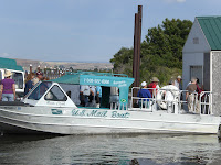
WHAT A FUN DAY! We boarded the jet boat for our 7 hour cruise. We got off to a “sticky” start. Seems there are a lot of little trees and sticks floating and it’s common for jet boats to suck up a stick, which necessitated a stop & fishing it out. But the captain’s grandson, Skylar (his mate) did a great job and we were back in business.


We stopped at a gift shop and café (yes it was in the middle of nowhere) for our continental breakfast and of course to buy souvenirs.

Once we got into “Hell’s Canyon” it was more wilderness as the only way to get there was by boat. There were no roads. We could not believe that people built vacation homes here! Our captain said it takes up to 3 years to build a house. EVERYTHING from nails to framing needs to be brought in BY BOAT. They use solar or generators for electricity. There were a few very, very beautiful homes and some that are not finished but up for sale. They call it Hell’s Canyon because in the summer it gets hotter than ___.

Our next stop was in Hell’s Canyon at a small camp type area. We were met at the dock by one of the hands in what he called his “Redneck Taxi.” That was quite cute.


We were served lunch by a girl who was part Souix, Nez Perce and another Indian tribe. She lives at the camp during the summer season and loves it when she has visitors to fuss over. She gets her supplies from the mail boat or any other boat who might be coming up river.

While on our journey, we ran into a guy who works for the government and does fish studies and he’s paid to fish in the canyon. That would be a cool job!

This is the area where Chief Joseph led 2,000 members of his tribe across the canyon and didn’t lose anyone (men, women, children or horses). The soldiers crossed the canyon a little further up river and lost 70% of their men.


We stopped at an area where there were pictographs which have been identified as 3-5,000 years old. We wer not allowed to get off the boat because in the past, people damaged the artifacts, so now you can only look from the boat.

The rock formation is columnar basalt formed when the earth cooled. The formations are different, depending on how quickly the earth cooled. It was really strange to see some vertical, horizontal, bowed…..


We took so many pictures that it was difficult to choose which ones to post.

Wednesday, June 17, 2009

Dillon, Montana

Dillon, Montana

Day 30, Picking up our guide at the visitor’s center, we saw a Lewis and Clark Diorama there. I give that project an “A.”


As we came out of the visitor’s center, Bill noticed the “Hamilton Free Public Drinking Fountain” so of course we had to take his picture.

We made quite a few Lewis and Clark stops throughout the day. Beaverhead Rock was the first site that Sacajawea recognized, confirming that Lewis and Clark were following the correct trail (or river).

You have to imagine a beaver swimming and all you can see is the top portion of his face and head. Once you can visualize that, you can see that this rock looks like a beaver head. Our guide had to show us an actual picture of a beaver before any of us could visualize it. So look for a picture of a beaver swimming and compare this rock. I wonder how long the Indians sat and starred at this rock to visualize a beaver head…..

Clark’s lookout was located just outside of the town up on some rocks. Our guide show us the exact rock that Clark stood on, so Marcia, one of our guests, Dot, and I just had to stand in the same place.


Rattlesnake Rock had a pictograph from the Indians indicating a rattlesnake. You can see the squiggly line in red. The area is also noted for a LOT of rattlesnakes, so I did not get out of the bus.

Camp Fortunate was a picturesque lake area where the expedition set up camp at the site in the picture below.

We had a prime rib lunch (really it was a dinner) at the Cross Ranch Cookhouse. It is one of the few family owned cattle ranches left. Big businesses have been buying up and running cattle ranches. This ranch has 3,000 heads of cattle (200 bulls) and gets about 500 calves every year! He sells the calves for $800 a piece. That’s a pretty good business! A storm was brewing off in a distance, so of course I had to take a picture of the sky.


After lunch we all wanted to nap on the bus, but off to Lemhi Pass, where the Continental Divide runs between Montana and Idaho.

We didn’t stay long because of the rain, but while we were there, an Indian tribe was running a 12 mile marathon up the mountain. Not only was it a steep grade, but it was rainy and chilly. They were in short sleeves! Talking to the Indians, we found that they are ancestors of Sacajawea! They held a (Shoshoni) reunion during the 100th year anniversary of the Lewis and Clark expedition and ever since have made it an annual reunion. They have chosen this area because it is where Sacajawea was born. Pictured in the middle is a direct decendent of Sacajawea.
On our way down the mountain, the road was so narrow that we had to have a lead car for the bus. Luckily, we only ran into one area where a car had to back up for us. We stopped to take pictures at the mouth of the Missouri River, where Bill took a drink. I think he thought it was the fountain of youth.

Bannack is where we ended our day, the local ghost town. We watched a 15 min. film about how the town and had a wonderful tour guide. This was a booming town during the gold rush.


We learned that it was not the people who mined for gold that got rich, but the merchants selling to the miners, or the “herdy gertie” girls would charge a nickel per dance. They called them “herdy gerdy” girls because they would dance to the musical instrument called a herdy gerdy.


Lolo Hot Springs, Montana

Day 31, we headed for one of our most challenging driving days. Over 2 steep passes. The first was not bad, Big Hole Pass (7,428 Altitude).


We stopped at Big Hole National Battlefield, where we viewed a good film (20 min) of the Nez Perce war. What a sad event. In May, 1877, the U.S. Government told the nontreaty Nez Perce that they would forcibly move them onto a new, smaller reservation if they did not do so willingly by June 14th. After a few small battles at various locations, at Big Hole on Aug. 9-10, the Nez Perce lost between 60-90 people (mostly women and children) in a surprise attack under Col. John Gibbon. After a 1,100 mile chase, the U.S. Army besieged the Nez Perce and their allies at Bear Paw in Northern, Montana. Some fled to Canada, others, exhausted from the ordeal, were forced to surrender. Below is a picture of the area where the Big Hole battle was held. You can see the tipis they have put up to honor the Indians who lost their lives.


BUT Chief Joseph Pass was quite steep. We held back at 25 miles per hour, as the suggested by the highway signs, with the exception of one switchback, which was 20 miles per hour.


Our brakes on the truck and trailer did fine, although it would have been nice to have that D brake. Before getting to the bottom, we had to make a right hand turn at a T intersection. To the left was Idaho and to the right was Montana.


After coming down Chief Joseph Pass, the rain helped to cool off our tires. We were told that Montana only gets about an inch and a half in the Dillon area, and I think they got their year’s supply while we were there.


At the bottom of the grade, the road straightened out and was a beautiful scenic drive along Bitterroot Creek,
with the exception of one thing. The remnants of a forest fire which spanned 15 miles (360,000 acres). How devastating.


We arrived at our campground just in time for a trip meeting for our next day of travel and time to jump in the hot springs. We did find out that this side of Montana gets a lot of rain, and it is proving true tonight. We hope the weather clears for our drive tomorrow and more importantly for our boat rise on Tuesday.

Day 32, it rained all night and the creek alongside the campground raised up a bit. Bill kept checking throughout the night prepared to wake everyone and evacuate.


I took a few pictures of the canyon where Lewis and Clark began their climb from the river canyon to the ridge (Lolo Trail) on their journey west in 1805.


Once over the LoLo Pass, we saw the Warm Springs suspension bridge which Bill decided to shake while I was walking across it…..

Most of the day was spent driving through Idaho along the Clearwater River. What a beautiful river and it looks like it would be fun to raft down.


Once we got close to Clarkston, Washington, the mountains (or hills) looked totally different.